
Welland Canal

![]() The Welland Canal is the other wonder on the Niagara Peninsula, this one made by humans.
The Welland Canal is the other wonder on the Niagara Peninsula, this one made by humans.
The Welland Canal connects Lake Ontario and Lake Erie through a series of eight locks, allowing ships to bypass the step of 167 feet / 51 metres at Niagara Falls.
The need to find a way for ships to bypass Niagara Falls led to the construction of four successive Welland Canals over the years. Work on the first began in 1824. Construction of the current canal started in 1913, was interrupted by World War I, and was completed in 1932. The development of the St. Lawrence Seaway in the 1950s ultimately led to the Welland Bypass project, a major realignment of the central section of the canal in the 1960s and 70s.
This isn't a typical Travel-Pix package. No gardens or castles or mountains, mostly just lots of photos of the canal, its ships, and its crossings. If naval architecture isn't your thing you can ignore the captions and just quickly flip through the pictures of the impressively big toys.
The link to the Pictures File is below the Sample Images.
Note: Even if you've visited this site often in the past please check out the new Viewing Setup Hints page to ensure that your browser controls display the PDFs as intended.
Quick Start: Welland-Canal.pdf
Top Sample Images Links to Pictures Files Map Contents Bottom
Sample Images
Here are a few sample images from the picture files. You can click or tap on these to see larger versions.

Lake Ontario, Port Weller

Entering Lock 1

Raised in Lock 1

Headed to Belgium, Lock 3

Leaving Lock 7
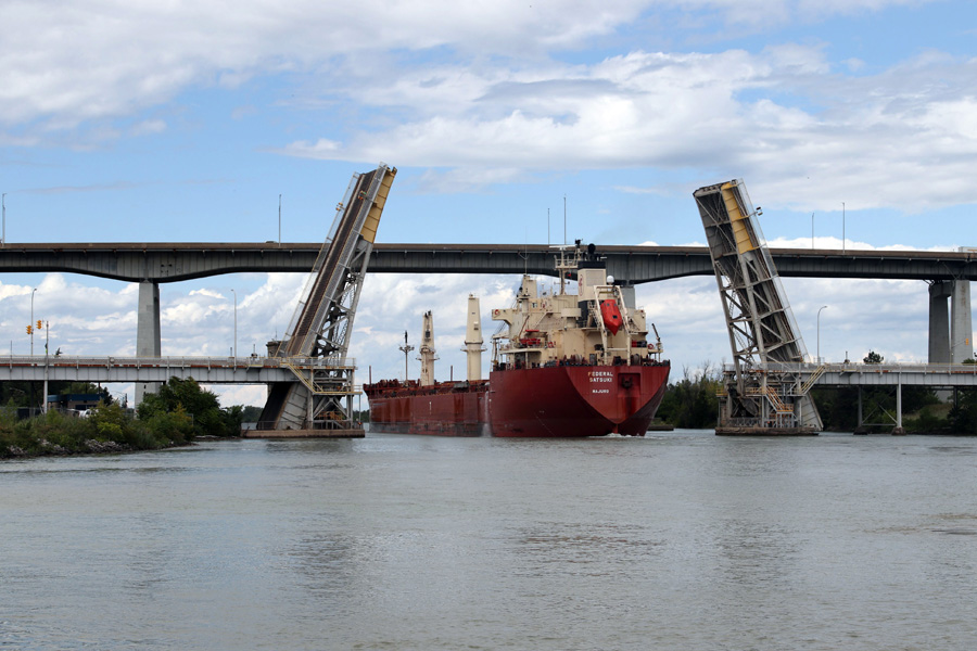
Homer Double Leaf Bridge

Allanburg Lift Bridge

Lake Erie, Port Colborne
Top Sample Images Links to Pictures Files Map Contents Bottom
Links to Files
You can access the PDF pictures file by clicking or tapping on the link below.
| File | Pages | Size |
|---|---|---|
| Welland-Canal.pdf | 91 | 32.9 MB |
Top Sample Images Links to Pictures Files Map Contents Bottom
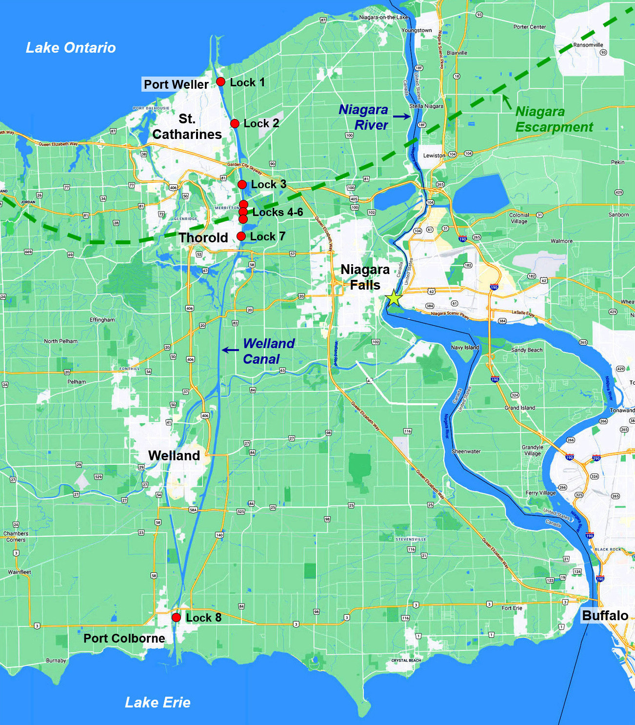
Map
The overview map below and a map of the central section of the Niagara River are included in the pictures PDF.
The overview map is included in a package of printable Ontario Maps if you wish a paper copy to follow along.
Top Sample Images Links to Pictures Files Map Contents Bottom
Table of Contents
The Contents table for this PDF is reproduced below. The combined Contents tables for all Ontario pictures files are included in the printable Ontario Contents PDF.
| Welland-Canal.pdf | |
| Contents | 2 |
| Introduction | 3 |
| Map | 5 |
| Canal Profile | 5 |
| Port Weller | 7 |
| Lake Ontario Entrance | 11 |
| Lift Locks | |
| Lock 1 | 19 |
| Lock 2 | 23 |
| Welland Canals Centre | 26 |
| Lock 3 | 27 |
| Twinned Flight Locks 4-6 | 33 |
| Lock 7 Viewing Centre | 39 |
| Lock 7 | 40 |
| Crossings | |
| Bascule Bridges | 51 |
| Double Leaf Bridge | 56 |
| Vertical Lift Bridges | 59 |
| Welland Bypass | 66 |
| Tunnels | 67 |
| Port Robinson | 69 |
| Guard Lock - Lock 8 | 72 |
| Port Colborne | 78 |
| Trends and Outlook | 81 |
| Lake Erie | 89 |
Top Sample Images Links to Pictures Files Map Contents Bottom