
Kawartha Summer Cruise

Here are photos from a 5-day cruise on a unique waterway connecting lakes and rivers in scenic central Ontario.
The Trent-Severn Waterway connects together some of the major lakes and rivers of the region to connect Lake Ontario to Lake Huron, bypassing Niagara Falls and Lake Erie. The Kawartha region is too rugged for agriculture, but the natural beauty of its lakes and forests is unique.
Construction of what is now a 386 km (240 mile) canal system began in 1833, and the system evolved in fits and starts over the decades. Although originally intended for commercial purposes, by the time it was completed in 1920 railways and larger boats made it largely obsolete. Separate history and information files are provided in the links list below.
But the Trent-Severn waterway has been a boon for tourism, and the 44 locks which link lakes and rivers across central Ontario are now used by a wide variety of recreational boaters … and this mini cruise.
Ontario Waterways Cruises offers summer cruises on the Trent-Severn Waterway. Its Kawartha Voyageur is a cruise ship scaled to navigate the canal system. The Kawartha Voyageur has a capacity of 45 passengers in 23 cabins, operated by a crew of 12 and a Captain. This cruise is not for thrill seekers. It took five days to cover 230 km (143 miles) – about 46 km (29 miles) a day.
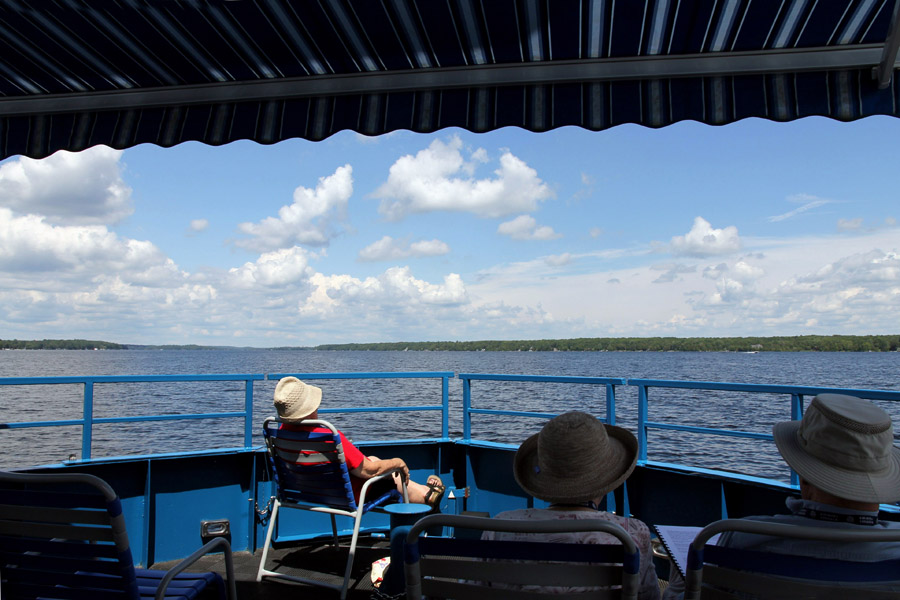
I had visited some of the locks before, but I had never sailed through any of them, and I'd seen very little of the lakes and rivers which they connect. I suspected that this cruise might yield some great photographs. You can judge.
The link to the Pictures File is below the Sample Images. Also provided are links to two Trent-Severn history PDFs, one short, one not so short. A Map and a Table of Contents are provided below that, both in on-screen and in printable forms.
Quick Start: Kawartha-Cruise.pdf
Top Sample Images Links to Pictures Files Map Contents Bottom
Sample Images
Here are a few sample images from the picture files. You can click or tap on these to see larger versions.
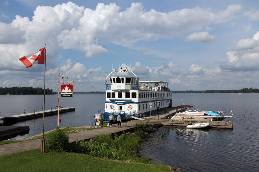
Kawartha Voyageur

Ashburnham Lock

Peterborough Lift Lock

Otonabee River
Clear Lake

Lovesick Lock

Bobcaygeon

Big Chute Marine Railway
Top Sample Images Links to Pictures Files Map Contents Bottom
Links to Files
You can access the PDF pictures file by clicking or tapping on the link below.
| File | Pages | Size |
|---|---|---|
| Kawartha-Cruise.pdf | 114 | 22.5 MB |
Information Files to open or download :
| File | Pages | Size |
|---|---|---|
| Trent-Severn-Short-History.pdf | 3 | 30 KB |
| Trent-Severn-Waterway-Wikipedia.pdf | 13 | 724 KB |
Top Sample Images Links to Pictures Files Map Contents Bottom
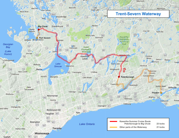
Map
The map below shows the route of the Kawartha Summer Cruise, from Peterborough to Big Chute.
A package of downloadable/printable Kawartha Cruise Maps is available. It includes the route map below and three detailed maps showing the locations of all the individual locks and tour features.
Top Sample Images Links to Pictures Files Map Contents Bottom
Table of Contents
The Contents table for this PDF is reproduced below. The combined Contents tables for all Ontario pictures files are included in the printable Ontario Contents PDF.
| Kawartha-Cruise.pdf | |
| Contents | 2 |
| Introduction | 3 |
| Route Map | 4 |
| Day 1 - Map - Days 1 & 2 | 5 |
| Departure | 6 |
| Ashburnham | 8 |
| Otonabee River | 14 |
| Peterborough Lift Lock | 16 |
| Trent University | 26 |
| Otonabee Locks | 32 |
| Clear Lake | 43 |
| Stony Lake | 49 |
| Burleigh Falls | 51 |
| Lovesick | 52 |
| Buckhorn | 53 |
| Day 2 - Buckhorn Lake | 56 |
| Bobcaygeon | 57 |
| Sturgeon Lake | 59 |
| Fenelon Falls | 61 |
| Cameron Lake | 65 |
| Rosedale | 66 |
| Day 3 - Map - Days 3 & 4 | 67 |
| Balsam Lake | 68 |
| Kirkfield Channel | 69 |
| Kirkfield Lift Lock | 71 |
| Canal Lake | 76 |
| Talbot River | 77 |
| Lake Simcoe | 83 |
| Day 4 - Orillia | 84 |
| Leacock Museum | 86 |
| Couchiching | 91 |
| Port Stanton | 95 |
| Day 5 - Map - Day 5 | 97 |
| Severn River | 98 |
| Swift Rapids | 101 |
| Severn Falls | 104 |
| Big Chute Maine Railway | 105 |
| Adieu Voyageur | 110 |
| Reflections | 112 |
| History | 113 |
| End | 114 |
Top Sample Images Links to Pictures Files Map Contents Bottom